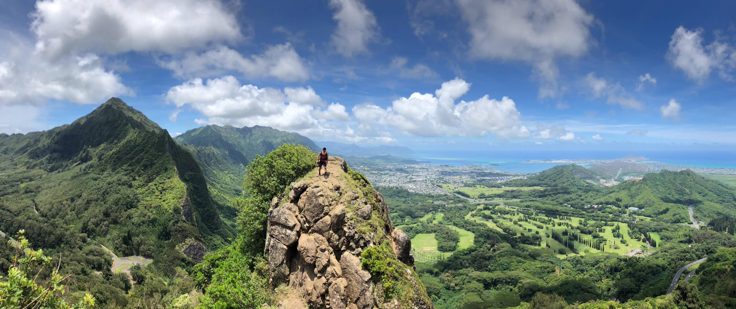
The locally famed Pali Notches Trail, is one of my favorite hikes in Hawaii. In less than half a mile, you’ll climb over 450 feet to some of the most epic panoramic views the island has to offer.
Generally considered challenging, this hike is best done when winds are low and when it has not rained recently.
Trailhead: Starts from the Pali lookout parking lot
Distance: 0.8 – 1 mile round trip
Elevation Gain: 462 ft. to first notch, 800 ft. to chimney
Popularity: Low – moderate
Hours: Parking is open from 6 AM to 6 PM.
When to go: Whenever winds are low and it has not rained.
Parking: Park in the Pali Lookout lot. It will cost $7 per car for non-residents.
Dogs: Not allowed.
Table of Contents
The History of the Pali Notches Trail
I’ve always found it interesting that the “notches” on this trail are actually man-made. They were supposedly used by ancient Hawaiian warriors who stood watch over Nu’uanu valley.
The Pali Notches Trail Experience
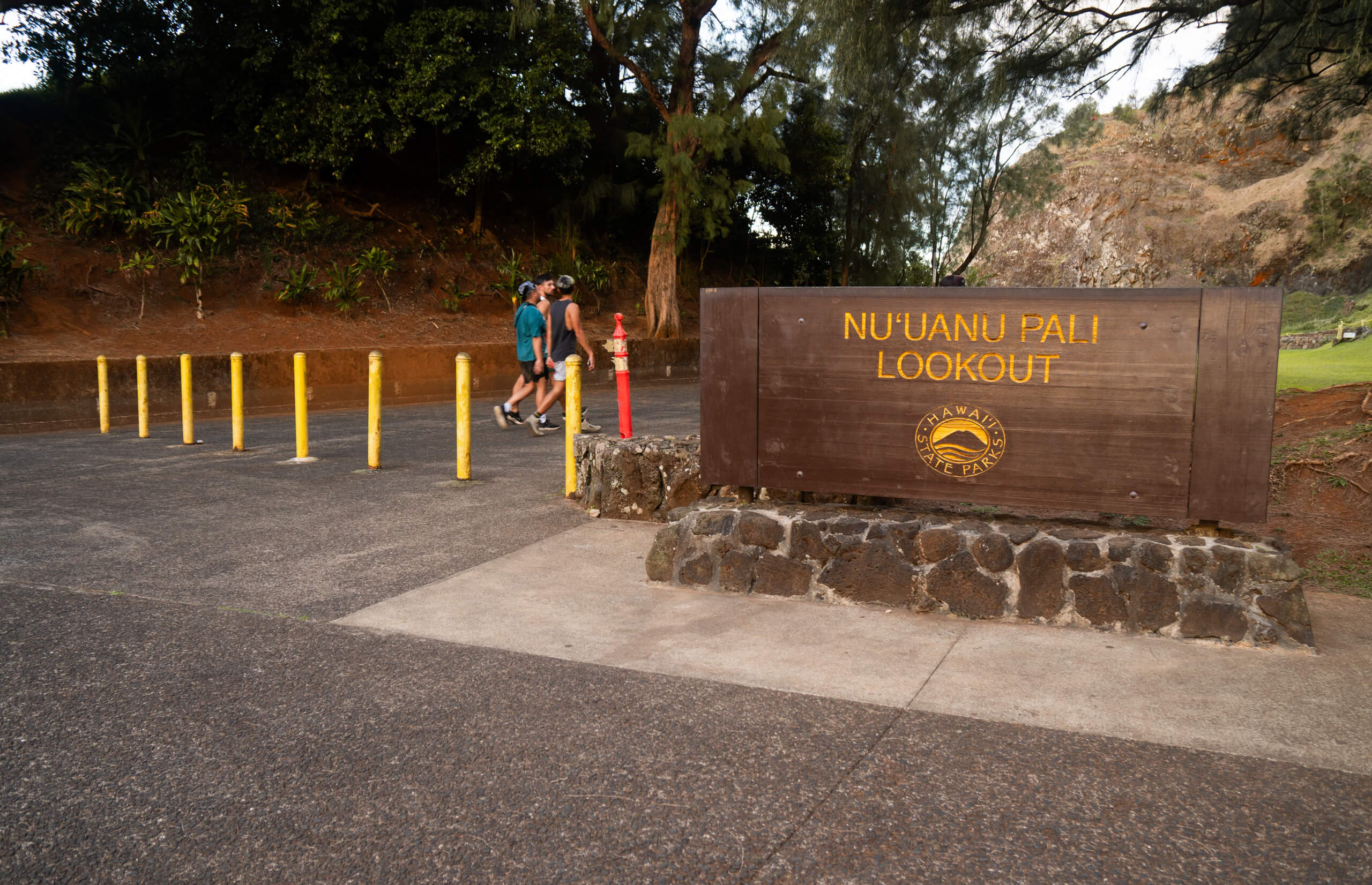
Getting There:
When getting to the hike, map to Nu’uanu Pali lookout and park in the designated lot. If you are arriving (or leaving) outside of 6 a.m. – 6 p.m. when the gates are open, you’ll need to park outside on the side of the road. This will add about 15-20 minutes to your hike.
Trailhead:
Head towards the lookout past this sign
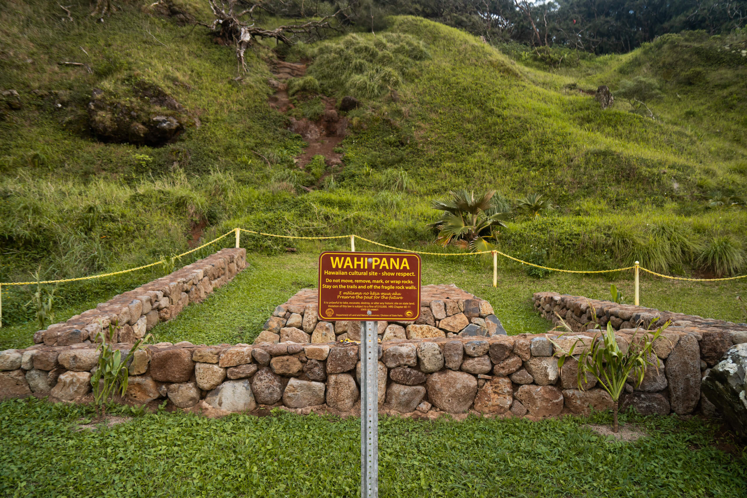
From the parking lot, head toward the Pali lookout viewing platform. Prior to the lookout you will see a cultural site to your right (pictured below). The trailhead for Pali Notches is right behind this site. Look for a dirt path leading up the hillside.
The closed trail begins behind this yellow chain leading up the hillside
Note that this is a closed and unmaintained trail. Proceed at your own risk. You will need to step over a yellow chain link rope to begin.
Tree Canopy:
After hiking up the initial open hill side you will soon enter a canopy of trees. Here you will note many different trail shoot offs generally all leading the same direction, up.
Initial hill leading into the tree canopy section
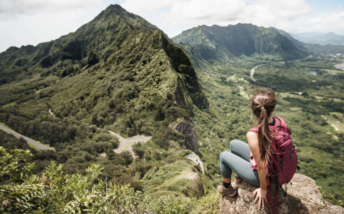
Open Landing:
Once out of the trees you’ll be rewarded with this view
Immediately following the canopy of trees you will step into a clearing, which will be your first real viewpoint of the pali notches trail. A large landing, clear of obstructions, and a great place for your first photo op.
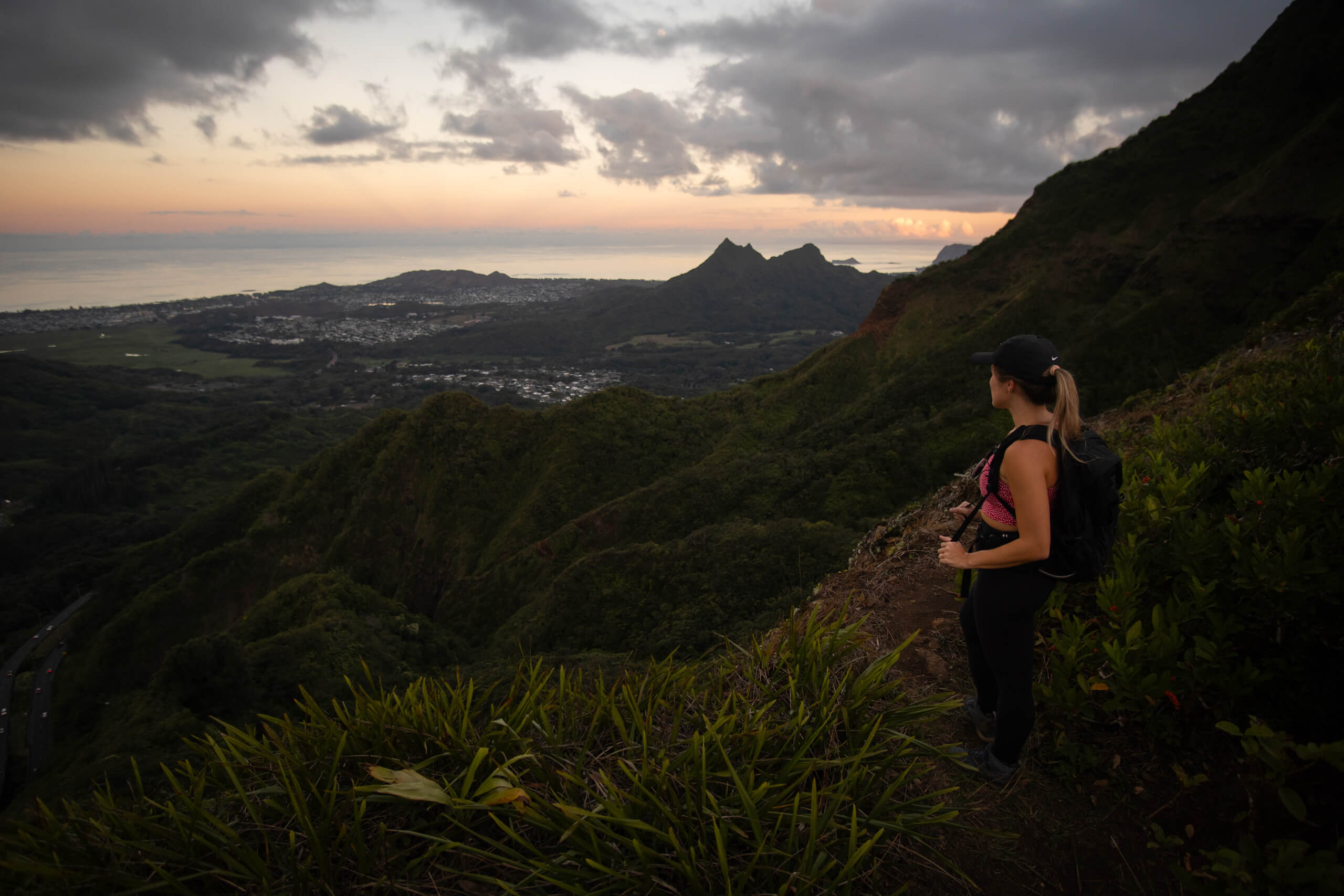
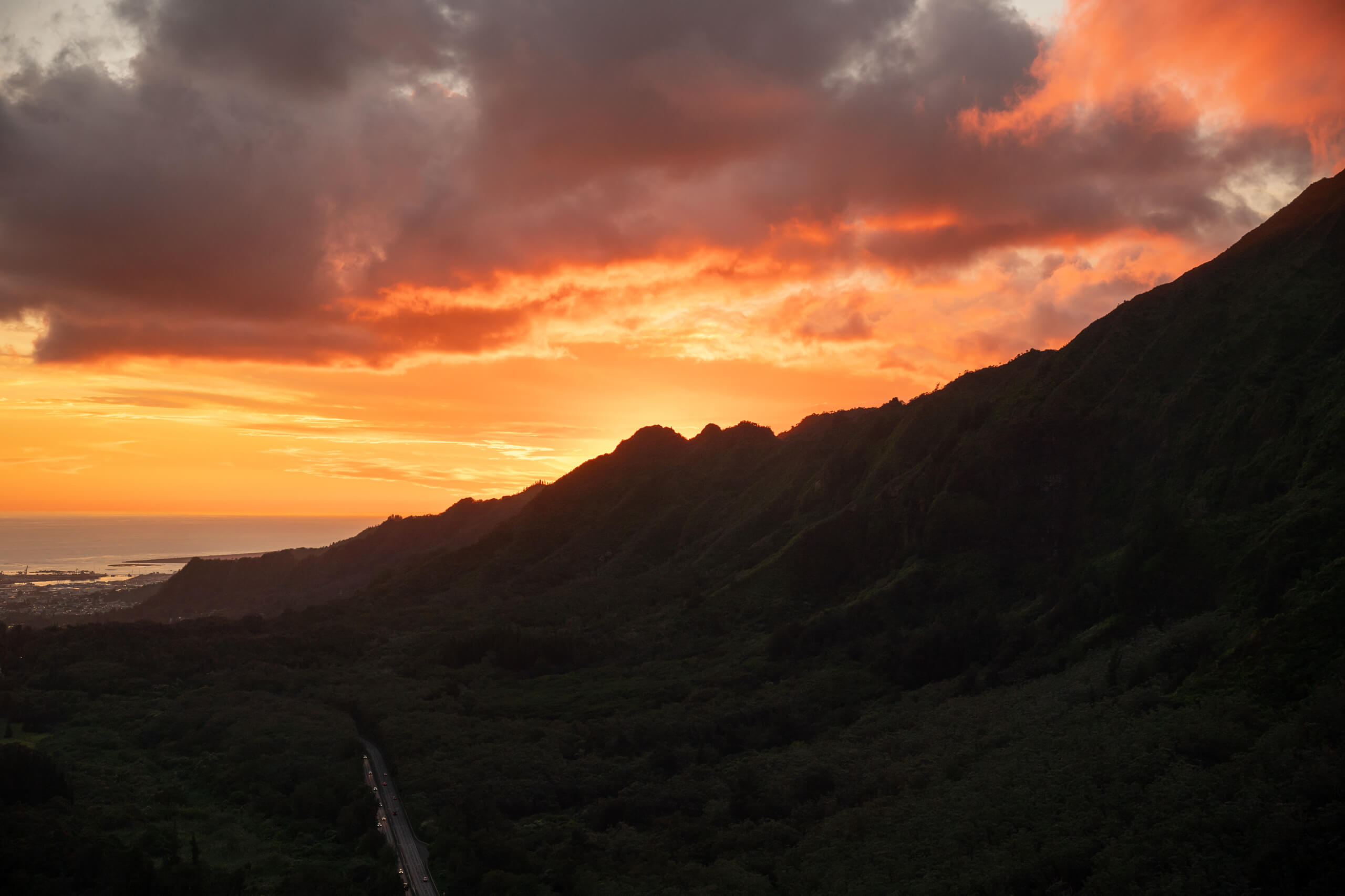
Looking out over Kailua at Sunset
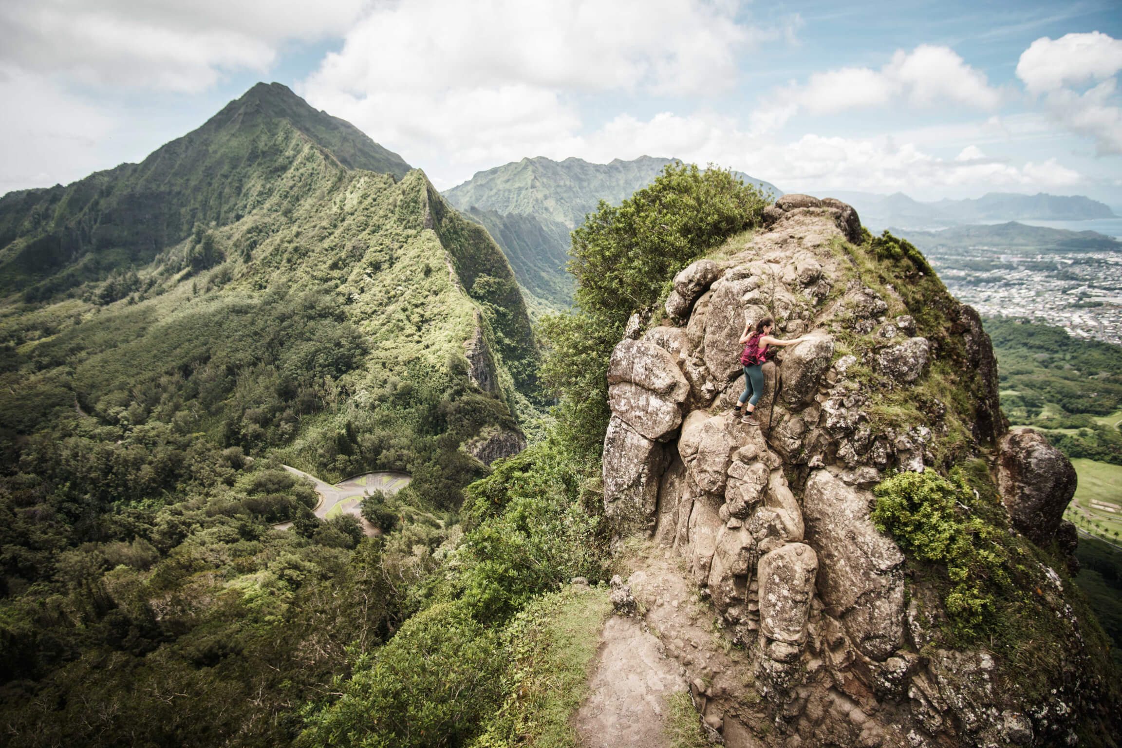
Scramble to Notches:
From this point on, the trail will turn into more of a scramble (class 3). You will often need to use your hands to climb up and over steep rocks.
Ascending to the top of the 1st Notch
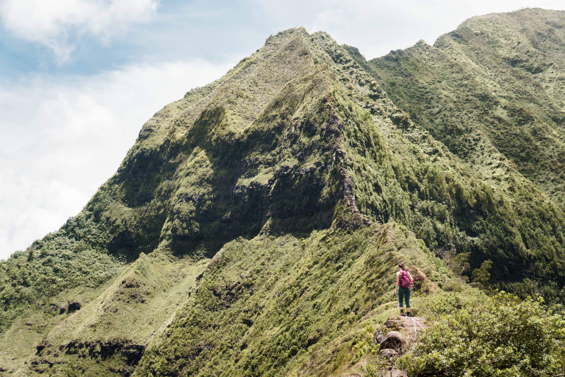
Your tree coverage will also be lost as you move forward, making you susceptible to gusty ridge line winds the rest of the ascent.
Ascending to the top of the 1st Notch
Sheer drop offs to your left will have you hugging the right side of the trail moving up the mountain. A short, but steep 20 minutes later you will reach the summit of first notch.
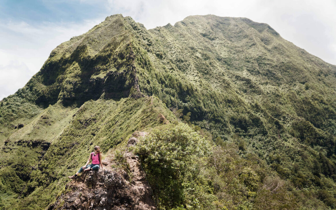
Summit:
The landing will be narrow but long and level enough for your group to gather together in admiration. Note: The first notch is where most people should stop. Unless you have climbing experience, the remainder of the hike is not worth the risk, especially if you are not used to Hawaii trails.
For those who wish to proceed, cautiously find your way down the first notch’s vertical face. Be careful not to rely on the ropes here as they are not maintained.
Descending the 1st notch
This is the easiest down climb of all the notches and if you have any difficulty it would be wise to turn back.
If you are moving forward you will catch respite in the flats between notches. You’ll note the winds subside and the footing is relatively easy in comparison. The 2nd notch on the trail will get significantly more narrow and the vertical face down will have less hand holds than the first.
Heading towards the Chimney
Once past the 2nd notch you will continue along the narrow ridge until you reach the base of a tall vertical rock face, locals know as the Chimney. This section of the hike is where most injuries/fatalities occur so exercise extreme caution if you choose to go up.
Panoramic summit views
Descent:
The top of the chimney is what most will consider the end of the trail. You will turn back and hike down the same you came up to get back to your car.
Remember, that going down is always harder than coming up.
Frequently asked questions
1. Is Pali Notches Legal?
There are no legal or maintained hikes beginning from the Pali lookout, meaning you could be subject to citation and or fines by doing this trail.
2. Is Pali Notches safe?
The Pali Notches trail is not maintained and traverses a steep ridgeline with drop offs. Only experienced hikers should attempt this trail.
3. How long does it take to hike Pali Notches?
If you are in reasonable shape you will be able to finish the trail in 1-2 hours despite the elevation.
4. What is the difference between Pali Notches and Pali Puka?
Pali Notches and Pali Puka are two entirely separate hiking trails. Although they share the same trailhead, one heads north along the ridge to a lookout hole (Pali Puka) and one heads south up to man made notches (Pali notches).
5. Is Pali Notches trail best for sunrise or sunset?
Either time is great to hike this trail! I’ve noticed it’s far less crowded in the evening than in the morning.
Disclaimer
This website, Aloha Adrian, shall not be held responsible for any legal issues, injuries, or lost individuals arising from the use of information provided. This information is not meant to give specific advice nor encourage persons to attempt the trail. You accept all consequences should you proceed to hike this closed trail.
Post photos were taken in collaboration with Matt Tonokawa.


Comments
Matt Tonokawa
Cool!